Tools
Visual Intelligence Scenarios in Action
See how this suite of powerful mapping and geospatial analysis tools can help you respond to critical events with greater clarity and confidence.

Get a Closer Look at Everything You Can Accomplish With Visual Intelligence
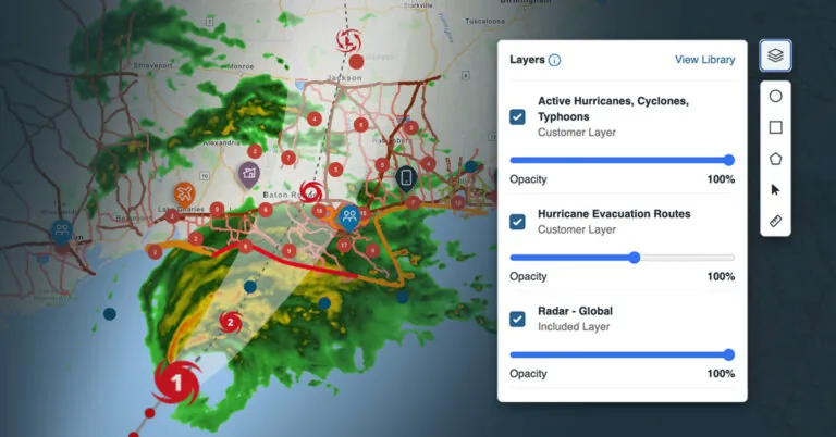
Managing risk at scale requires context—but with data scattered across multiple sources, making quick, informed decisions can be a challenge. AlertMedia’s Visual Intelligence provides a complete view of developing risks, combining weather, disaster, and company data into one intuitive platform.
See how everything connects with this visual breakdown
Download this infographic to explore how you can use Visual Intelligence to:
- Connect your people, assets, threats, and contextual data into a single map view
- Pinpoint impacted locations with greater precision using Esri’s ArcGIS technology
- Access map layer data ranging from local air quality to global tropical storm radars
- Save and retrieve entire map workspaces to switch context quickly and efficiently

